Specialized commands frequently used in civil/road drawing work
How to use
- Method 1
- Command Icon Bar > Command View All > Civil/Road
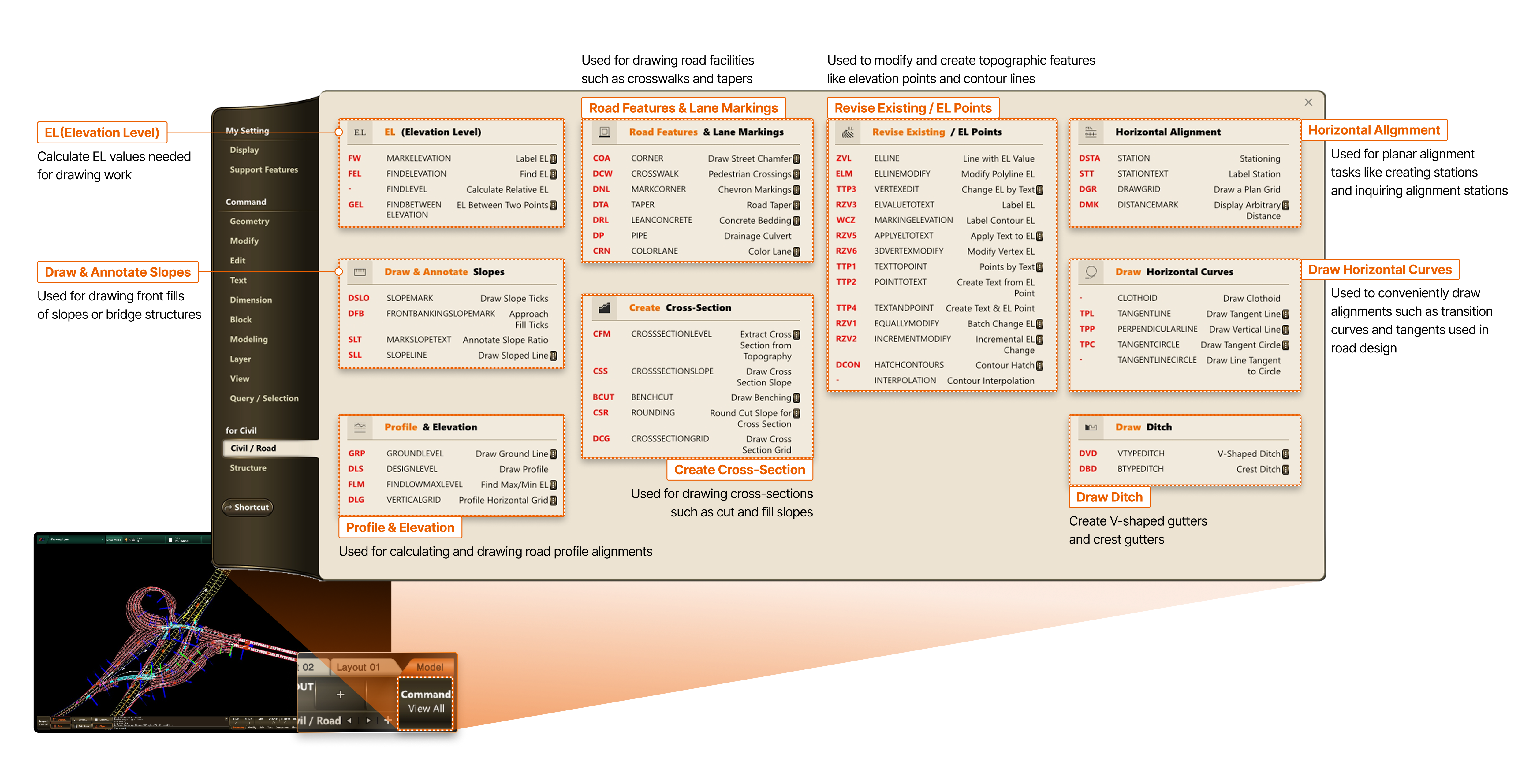
- EL(Elevation Level)
- Calculate EL values needed for drawing work
- Draw & Annotate Slopes
- Used for drawing front fills of slopes or bridge structures
- Road Features & Lane Markings
- Used for drawing road facilities such as crosswalks and tapers
- Road Features & Lane Markings
- Used for drawing road facilities such as crosswalks and tapers
- Revise Existing / EL Points
- Used to modify and create topographic features like elevation points and contour lines
- Horizontal Alignment
- Used for planar alignment tasks like creating stations and inquiring alignment stations
- Draw & Annotate Slopes
- Used for drawing front fills of slopes or bridge structures
- Create Cross-Section
- Used for drawing cross-sections such as cut and fill slopes
- Draw Horizontal Curves
- Used to conveniently draw alignments such as transition curves and tangents used in road design
- Profile & Elevation
- Used for calculating and drawing road profile alignments
- Draw Ditch
- Create V-shaped gutters and crest gutters